
Greek Property Check
Back to home

Illustrative sample · Fictional property and findings. No real address, parcel identifier or location is shown. The format is the same as the report for your property. See a real sample

Sample report · 22 September 2026

A detached house, before you commit

Professional review recommended

One public-data signal needs a clear answer from a Greek professional before you put down a deposit or travel.

Illustrative sample · Fictional property and findings. No real address, parcel identifier or location is shown. In this example, a mapped flood zone overlaps part of the plot. That is a question for your engineer—not proof that the house has flooded. The other example checks show how findings, gaps and next steps appear in your report.

Example layers
4
Signals
1
Questions
4
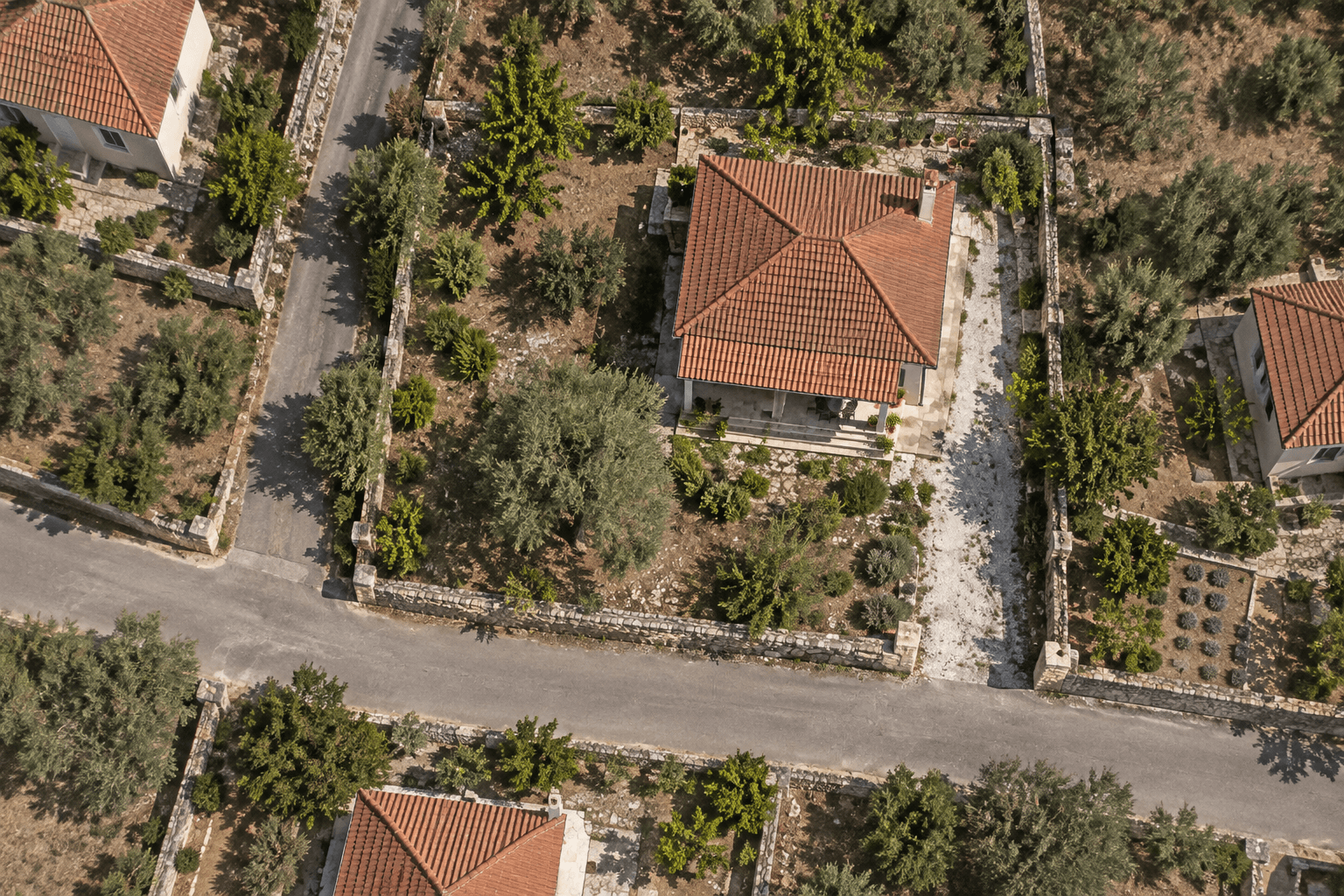
Overhead view of a fictional Greek house with an illustrative parcel boundary; not real satellite imagery or cadastral data
Illustrative parcel boundary

WHAT TO DO NEXT

  1. 01Share this report with your lawyer.
  2. 02Organise an engineer review.
  3. 03Request the building permit file.

This is not legal, engineering, or tax advice. It is a pre-check for what should be verified before proceeding.

02

Signals at a glance

Every check in this report, most important first. Select a row to read the detail.

03

Findings in detail

What was found, what it means, what stays unknown and what to ask next, for each check.

Needs attention1

What it means
An overlap is a reason to investigate. It does not show whether the house has flooded or predict damage.
What was found
Example: a mapped flood zone overlaps part of the plot.
What stays unknown
Illustrative example, not a finding for a real property.
Source limit
This source provides spatial context only. It does not prove legality, safety, ownership, permits, or full absence of risk.
Ask next
Ask your engineer about the building’s position, drainage and any local flood history before proceeding.

Public-data signal: Mapped overlapHow clearly the source answered: Indicative resultWho should verify: Civil engineer · Lawyer / notary

No signal in the tested data3

04

Location & parcel

The location you selected, and the public cadastre record found for it.

An example, with no identifiable location

Overhead view of a fictional Greek house with an illustrative parcel boundary; not real satellite imagery or cadastral data
Illustrative parcel boundary

This is a generated aerial illustration of a fictional property, not real satellite imagery. No real cadastral outline, coordinates or address is included. Your own report uses the parcel you confirm on the map.

05

Next steps with your professionals

Questions to copy into an email, grouped by who should answer them.

Lawyer / notary1

  1. 1Ask your lawyer to compare the cadastral record with the title, and your engineer to check the survey.

Civil engineer3

  1. 1Ask your engineer about the building’s position, drainage and any local flood history before proceeding.
  2. 2Ask your engineer to verify the current forest map and any pending decisions that affect the plot.
  3. 3Ask your engineer which designations and planning restrictions apply to the property.

Not covered by this report

Public geospatial data cannot answer these. Keep them on your list for the right professional.

  • Title, ownership and encumbrances

    Title, ownership, encumbrances, and contract terms require document review by a lawyer or notary.

    Ask: Lawyer / notary

  • Building permits, alterations and structural condition

    Permits, legalization status, and unauthorized works are not verified by spatial layers; they need permit-file review and site inspection.

    Ask: Civil engineer · Lawyer / notary

  • Buildability, legal access and utility connections

    This topic cannot be concluded from the automated public-data layers in this report. Use it as a professional follow-up item, not as a positive or negative signal.

    Ask: Relevant professional

  • Market value, rental returns and tax obligations

    This topic cannot be concluded from the automated public-data layers in this report. Use it as a professional follow-up item, not as a positive or negative signal.

    Ask: Relevant professional

06

Sources

These are fictional findings, not results from a source query. In your own report, each finding identifies the datasets used, their dates and their limitations.

Report details and terminology

Illustrative sample · Fictional property and findings. No real address, parcel identifier or location is shown.

Terms you may see

Cadastre
Public parcel mapping system. It does not prove ownership.
KAEK
Greek cadastral parcel code (ΚΑΕΚ). Identifies the public parcel confirmed for the check, not proof of ownership.
YPEN
Ministry of Environment and Energy (Greece). In this report, mainly the official national flood-risk maps, not a site drainage survey.
Map pin
The point used to find a parcel. The report uses the confirmed parcel outline when one is stored. It is not an official legal boundary.
Natura 2000
EU protected nature network. Environmental rules may apply.
Forest map
Public forest-coverage map, legally significant in Greece. Verify on site.
PFRA
Preliminary flood-risk assessment with recorded historic flood events. Useful context, not a prediction for the property.
CDDA
Nationally designated protected areas. Complements Natura context, but does not replace legal or environmental review.
CORINE
European land-cover mapping at broad scale. It describes area context, not parcel-level land-use permission.
OpenStreetMap
Open map data for roads, settlements, coastline, transport, and services. Completeness varies by area.
NOAFAULTs
Public active-fault dataset from the National Observatory of Athens. It is spatial context, not structural or geotechnical assessment.

07

Limitations

Public pre-check, not legal or technical certification

This report is a public-geospatial-data pre-check of the location you selected. It is not legal, engineering, tax, or insurance due diligence and does not replace a lawyer, engineer, notary, accountant, insurer, or official authority.

It does not certify or verify ownership, contract status, permits, safety, buildability, compliance, or short-term rental approval.

Absence of a signal in tested layers does not prove absence of risk. Items not checked automatically require professional verification.

See what the available public data shows for your own property.

Check your property
Greek Property CheckEnd of report